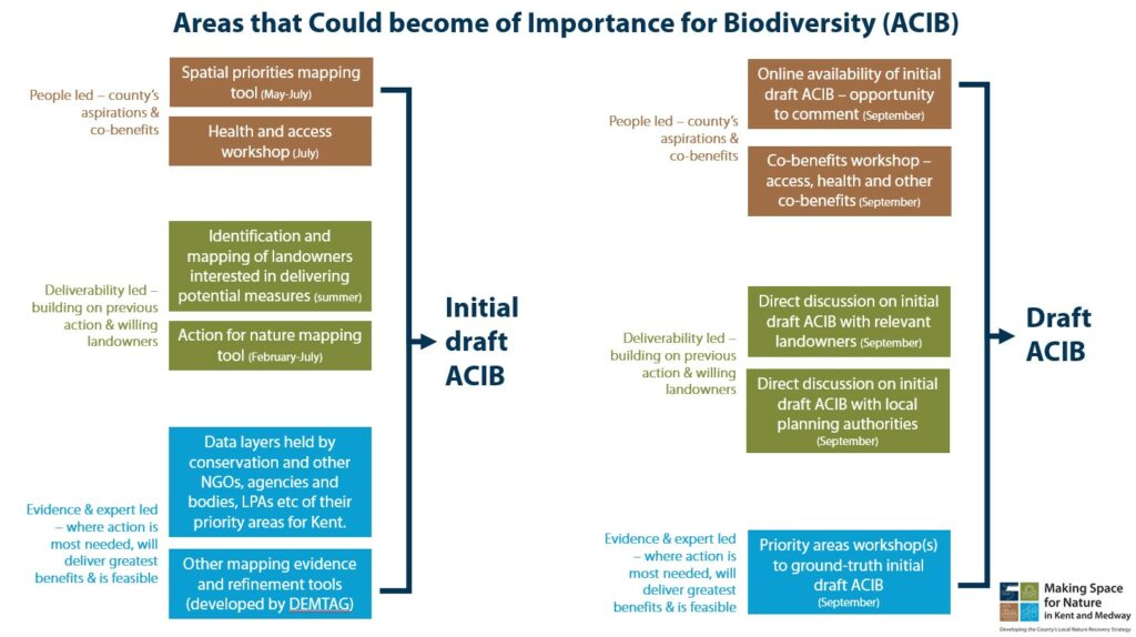
What we want – mapping areas of opportunity
Identifying locations to recover or enhance nature is the local nature recovery strategy’s main purpose – so this final stage of the strategy development was very important. The project mapped, with partners, the areas which they believe could become of particular importance for biodiversity; or where the recovery or enhancement of biodiversity deliver a nature-based solution to an environmental issue. These areas are collectively referred to as ‘areas that could become of particular importance’. And it is these areas that the county proposes that effort should be concentrated to restore habitat, to achieve the most for biodiversity and the wider environment.
Working with partners and stakeholders, the project looked at feasible locations and selected those that would have the greatest impact on the priorities and/or would enable the greatest connectivity across the landscape of the county.
All the work that had been developed in the stages before was also used to inform this mapping stage.

Feb 2024
Development of online priorities mapping tool
From February to April, the project will develop an online mapping tool that will enable stakeholders to identify their spatial priorities.
Apr 2024
Online priorities mapping tool finalised
From February to April, the project will develop an online mapping tool that will enable stakeholders to identify their spatial priorities.
May 2024
Development of connectivity models and other mapping refinement tools
Over the spring period, models, mapping layers and other refinement tools will be developed to assist with developing the ACIB.
May 2024
Launch of online priorities mapping tool
Stakeholder mapping exercise, identifying where action should be focused. Opportunity to register priorities through to July.
Aug 2024
Development of initial draft ACIB
Over the summer period, pulling together the stakeholder’s spatial priorities and other models, evidence and refinement tools, the project will develop the initial draft areas that could become of importance for biodiversity (ACIB) map.
Sep 2024
Mapping workshops
Workshops to review and refine the initial draft ACIB map and identify potential conflicts and resolutions. There will also be direct liaison with landowners and sectors as required.
Oct 2024
Finalisation of ACIB
Including ACIB mapping report, with decisions and justifications and any unresolved matters.
Nov 2024
Milestone completed
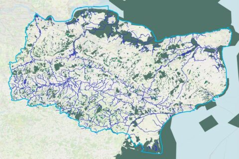
Map of areas that could become of particular importance for biodiversity.