
Mapping potential measures and identifying areas that could become of particular importance for biodiversity
The purpose of mapping the potential measures is to determine where in the county effort should be concentrated to restore habitat, to achieve the most for biodiversity and the wider environment. The potential measures mapping was created by an iterative process which is outlined below:
Mapping potential measures
Initial approach to mapping of potential measures
Available data and evidence to inform and define the mapping of each potential measure was reviewed, to determine whether the measure could be mapped as per the statutory prerequisites of a Local Nature Recovery Strategy. These require the Strategy to be ambitious in proposing change but also realistic in the need to concentrate effort where it will have most benefit. The guidance notes that indiscriminate or widespread mapping of areas will not aid the targeting of available resources and therefore, feasible locations should be considered according to which would have the greatest impact on achieving the priorities and which would achieve greater connectivity.
Ensuring the value of the whole county for nature recovery was represented by the maps
The initial approach of only mapping measures that could be sufficiently refined in order to meet the Local Nature Recovery Strategy mapping requirements, meant that some areas of the county appeared to have no potential or importance for nature recovery. This was not the case.
Instead, many of these areas had a number of potential measures mapped to them but these were management actions that could be applied anywhere, with no advantages gained from delivery in one area over another. In some cases the available data simply was not sufficient to enable to the required refinement. Whilst the resulting maps did not meet the mapping requirements of the Local Nature Recovery Strategy guidance, stakeholders viewed the exclusion of these maps from the Strategy as problematic and unrepresentative of the actual value of these areas to nature recovery.
Consequently, measures were categorised based on whether they led to targeted and defined action or whether they applied more widely across the county, with some mapping possible, based on the extent existing habitat or potential for that habitat. Measures are therefore presented as either a potential measure or a wider measure:
- Potential measure – the proposed action has been identified for an area or areas that will have the greatest impact on achieving the priorities and which would achieve greater connectivity. Collectively, potential measures identify areas that could become of particular importance for biodiversity and are a constituent part of the formal Local Nature Recovery Strategy’s local habitat map
- Wider measure – a proposed action which would either be similarly beneficial over wide areas or it was not possible to determine specific locations to carry out the proposed action. Collectively, wider measures identify areas of additional opportunities for nature recovery but do not form a part of the formal Local Nature Recovery Strategy’s local habitat map
The data and mapping approach for each potential measure can be found in the appendices.
In some cases, potential measures were not mapped at all, as they could be applied widely across the Strategy area, with few spatial limitations. These measures have been included under the land management principles for each priority.
Refining and reviewing the maps
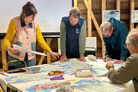
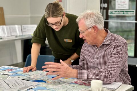
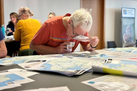
The potential measures mapping was reviewed and refined with stakeholders and partners at a series of workshops and meetings, including direct discussions with landowners, local planning authorities and other delivery partners and decision-making bodies. This provided extensive local knowledge and expertise, which allowed some verification of the desk-based mapping work, further targeting to more defined areas, and the consideration of deliverability in the areas proposed. Additional refinement of the potential measures mapping focused on:
- opportunities to address wider environmental challenges using nature-based solutions
- other wider benefits such as health and access
- opportunities to build on existing action or delivery
The final data and mapping approach for each potential measure can be found in the appendices.
Mapping potential measures to nationally designated sites
Potential measures have been mapped to areas of particular importance for biodiversity. It is recognised that the majority of designated sites in the county (Sites of Special Scientific Interest, Special Areas of Conservation, Special Protection Areas, Ramsar sites and National Nature Reserves) will already have in place management plans and approaches, with some of these designed to maintain and/or protect the feature(s) the site is designated for. It would therefore not be appropriate for the mapped potential measure to override something already in place. This is particularly the case where the potential measure relates to the creation of habitat. However, as the potential measures mapping has been designed to deliver a coherent network for nature recovery across the Strategy area, measures mapped to designated areas have been retained, so their appropriateness can be considered at the point of planning for delivery or when and if the management plan is reviewed. How potential measures may be applied to nationally designated sites in the future will be an ongoing discussion during the Strategy’s delivery, monitoring and review phases.
Inclusion of areas identified for development
During the development of the mapping, the work questioned whether Local Plan site allocations, which identify specific locations for future development, should be excluded from the potential measures mapping and, consequently, the areas that could become of particular importance for biodiversity. In agreement with the county’s local planning authorities, it was agreed that such sites would not be excluded, for the following reasons:
- The Local Nature Recovery Strategy does not instruct what should happen on land; rather, it informs. Therefore, overlap with a potential measure does not prevent development on that land. It does, however, offer direction on what measures could be integrated within the development site to aid nature recovery.
- If allocated sites were removed, it would undermine the integrity of the Strategy and its role in biodiversity net gain – that is, identifying strategically significant areas for nature and informing strategic significance within the metric. The potential measures will also indicate what actions (gains) would be most beneficial. Their removal would result in missed opportunities to steer onsite biodiversity net gain.
- Removal of allocated sites would give the message that nature has no place within development or growth, suggesting that they are incompatible. If planned and designed correctly, necessary development has the potential to contribute to nature recovery efforts and the removal of future sites would undermine this.
- The potential measures mapping identifies opportunities for nature-based solutions, which can assist developers in finding solutions to challenges on site.
For the same reason, sites where development is coming forward were also included.
It was determined that sites where development has already been through the planning process or where construction is underway would be excluded except for measures which fell under urban, successional, connectivity, freshwater and coastal priorities. It was considered that measures under these priorities would still be applicable for newly developed land in the future.
Mapping areas that could become of particular importance for biodiversity
Areas that could become of particular importance for biodiversity are where the Strategy proposes effort should be concentrated to restore habitat, to achieve the greatest gains for nature and derive the greatest benefits from a healthy, functioning environment. They are the areas of Kent and Medway where targeted action will enable us to deliver on the priorities laid out by the Strategy.
The first stage in mapping the areas that could become of particular importance for biodiversity was the mapping of the potential measures. However, despite best efforts to focus the mapping of potential measures, the resulting draft areas that could become of particular importance for biodiversity were considered to have too broad a coverage to satisfy the purpose of the Strategy’s spatial element – that being to effectively and efficiently target available resources.
To address this, connectivity modelling was used to refine and target action further, with priority given to potential measures located in areas of low species flow and connectivity bottlenecks and where action would provide buffering/linking of existing areas of particular importance for biodiversity. The rationale for this approach was that a more joined up, connected landscape was the ultimate ambition of the Strategy, if the applied Lawton principles are considered a hierarchy of going from better to joined up.
To create the areas that could become of particular importance to biodiversity, the refined potential measures mapping was laid over the areas of particular importance for biodiversity to identify where the areas that could become of particular importance to biodiversity could not be situated, given that the areas of existing importance cannot overlap with the areas of opportunity.
Reports from this stage of the Strategy's development
MS4N LNRS mapping workshop report – full feedback
Download PDF (2 MB) - MS4N LNRS Mapping Workshop Report Full Feedback
MS4N LNRS mapping workshop report – mapping feedback and proposed actions
Download PDF (1,019 KB) - MS4N LNRS Mapping Workshop Report Mapping Feedback And Proposed Actions
MS4N LNRS mapping workshop report – proposed additional sites
Download PDF (902 KB) - MS4N LNRS Mapping Workshop Report Proposed Additional Sites
MS4N LNRS mapping workshop report – feedback from planning authorities
Download PDF (997 KB) - MS4N LNRS Mapping Workshop Report Feedback From Planning Authorities

Illustration of Kent and Medway LNRS mapping process
Download PDF (274 KB) - Illustration Of LNRS Mapping Approach