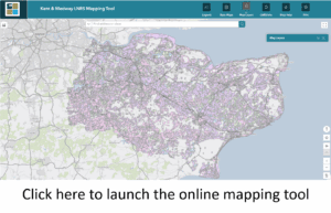
The Kent and Medway Local Nature Recovery Strategy mapping tool allows you to view online
- Areas of particular importance for biodiversity are the Strategy area’s national conservation sites (National Nature Reserve, Sites of Special Scientific Interest, Special Protection Areas, Special Areas of Conservation, Marine Conservation Zones and Ramsar), Local Nature Reserves, Local Wildlife Sites and irreplaceable habitat. The areas eligible for inclusion in this map is tightly defined by the Local Nature Recovery Strategy regulations.
- Potential measures mapping identifies where the action determined as necessary for our nature recovery priorities should be strategically targeted to achieve the greatest gains for biodiversity and deliver the widest environmental benefits. It is only potential measures that are eligible for the biodiversity net gain strategic significance uplift – and only when those potential measures are delivered in the areas they have been mapped to.
- Areas that could become of particular importance for biodiversity comprise the extent of the potential measures, with areas of particular importance for biodiversity excluded. These are the areas where the Strategy proposes effort should be concentrated to restore habitat, to achieve the greatest gains for nature and to derive the greatest benefits from a healthy, functioning environment. They are the areas of Kent and Medway where targeted action will enable us to deliver on the priorities laid out by the Strategy.
- Wider measures are proposed actions which would be similarly beneficial over wide areas or those where it was not possible to determine specific locations to carry out the proposed action. Collectively, these wider measures identify areas of additional opportunities for nature recovery but do not form a part of the formal Strategy’s local habitat map. Wider measures are NOT eligible for the biodiversity net gain strategic significance uplift – this only applies to potential measures.
Click here for guidance on how to use the online mapping tool